OE-spec
Specifications
| SKU | 1380022 |
Fitment
WATERPROOF CHARTS · 1380022
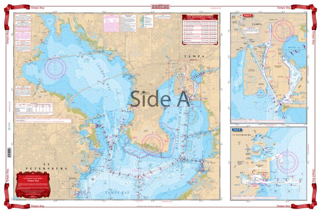
Waterproof Charts 22 Tampa Bay Navigation
Waterproof Charts 22 Tampa Bay Navigation Best detailed coverage for both North and South Tampa Bay and to 10 miles offshore. Includes Manatee River to Interstate 75 Bridge as well as Boca Ciega Bay. Includes Old Tampa Bay. Has blown up detailed insets for St. Petersburg and Davis Island and Hookers Point. This Tampa Bay nautical chart is going to become your best friend while you’re on the water.
Ninguna tienda cerca de ti tiene este repuesto todavía
Este repuesto está en nuestro catálogo, pero ninguna tienda cercana lo tiene por ahora. Vuelve a consultar pronto o busca un repuesto similar disponible cerca de ti.